Geolocate

Duren topographic map

Click on the map to display elevation.

About this map

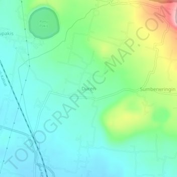
Name: Duren topographic map, elevation, terrain.

Location: Duren, Lumajang, East Java, Java, Indonesia (-8.03272 113.25973 -7.99272 113.29973)

Average elevation: 229 m

Minimum elevation: 173 m

Maximum elevation: 383 m

Other topographic maps

Click on a map to view its topography, its elevation and its terrain.

Oro-oro Ombo

Indonesia > East Java > Lumajang

Average elevation: 1,079 m

Gear up for your next adventure:

🧊Portable Cooler - Keep food and drinks cold during outdoor adventures
🔦LED Flashlight - Powerful and long-lasting flashlight for camping and emergencies
🧦Crew Hiking Socks - Comfortable socks for long-distance hikes
🦶Hiking Shoe Insoles - Added support for high arches and long days on feet
Camping Coffee Maker - Brew fresh coffee anywhere on the topographic map

As an Amazon Associate, this site earns from qualifying purchases at no extra cost to you.