
Thank you for supporting this site ❤️
Make a donation
Make a donation
Gear up for your next adventure:
As an Amazon Associate, this site earns from qualifying purchases at no extra cost to you.
Çayönü topographic map
Click on the map to display elevation.
Thank you for supporting this site ❤️
Make a donation
Make a donation
Gear up for your next adventure:
As an Amazon Associate, this site earns from qualifying purchases at no extra cost to you.
About this map
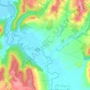
Name: Çayönü topographic map, elevation, terrain.
Location: Çayönü, Mudanya, Bursa, Marmara Region, Turkey (40.27721 28.62584 40.31721 28.66584)
Average elevation: 68 m
Minimum elevation: 23 m
Maximum elevation: 152 m
Thank you for supporting this site ❤️
Make a donation
Make a donation
Gear up for your next adventure:
As an Amazon Associate, this site earns from qualifying purchases at no extra cost to you.