
Make a donation
Gear up for your next adventure:
As an Amazon Associate, this site earns from qualifying purchases at no extra cost to you.
Waldow/Brand topographic map
Click on the map to display elevation.
Make a donation
Gear up for your next adventure:
As an Amazon Associate, this site earns from qualifying purchases at no extra cost to you.
Waldow/Brand
Die Dorfkirche in Waldow wurde vermutlich um das Jahr 1709 als Fachwerkgebäude errichtet. Die Kirche wird beim Brandenburgischen Landesamt für Denkmalpflege als Baudenkmal geführt. Um 1879 gehörte das Gut Waldow der Familie Fuhrmann, Größe 1075,16 ha. Hans Georg Oeder war vor dem Ersten Weltkrieg Eigentümer des Rittergutes Waldow mit Neue Schanze und Vorwerk Schäferei. Ihm zur Seite stand der Administrator Hans Loycke als Verwalter, was dafür spricht, dass eine höhere Kreditbelastung seitens eines Finanzgebers (Ritterschaftsbank/Märkische Landschaft genannt.) vorlag.
Make a donation
Gear up for your next adventure:
As an Amazon Associate, this site earns from qualifying purchases at no extra cost to you.
About this map
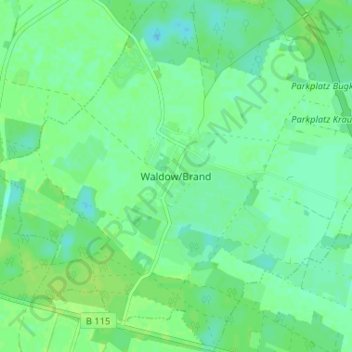
Name: Waldow/Brand topographic map, elevation, terrain.
Average elevation: 55 m
Minimum elevation: 49 m
Maximum elevation: 60 m
Make a donation
Gear up for your next adventure:
As an Amazon Associate, this site earns from qualifying purchases at no extra cost to you.