
Iria Flavia topographic map
Click on the map to display elevation.
About this map
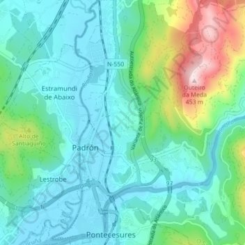
Name: Iria Flavia topographic map, elevation, terrain.
Location: Iria Flavia, Padrón, Sar, La Coruña, Galicia, España (42.71859 -8.67206 42.76967 -8.62479)
Average elevation: 95 m
Minimum elevation: -1 m
Maximum elevation: 435 m
Other topographic maps
Click on a map to view its topography, its elevation and its terrain.