Geolocate

Iten topographic map

Click on the map to display elevation.

About this map

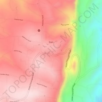
Name: Iten topographic map, elevation, terrain.

Location: Iten, Keiyo North, Elgeyo-Marakwet County, Kenya (0.65379 35.49494 0.68086 35.51646)

Average elevation: 2,281 m

Minimum elevation: 2,055 m

Maximum elevation: 2,391 m

Gear up for your next adventure:

🎒Backpack Rain Cover - External shield to keep your entire pack dry
🧤Rechargeable Heated Gloves - Extreme warmth for Canadian winter expeditions
🥾Hiking Leggings - Comfortable leggings for outdoor activities
🥾Approach Boots - Comfortable boots for hiking and climbing approaches
Family Camping Tent - Spacious tent suitable for family camping trips

As an Amazon Associate, this site earns from qualifying purchases at no extra cost to you.