Geolocate

Leominster topographic map

Click on the map to display elevation.

About this map
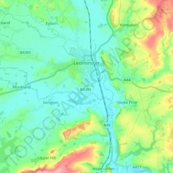
Name: Leominster topographic map, elevation, terrain.

Location: Leominster, Herefordshire, England, United Kingdom (52.18211 -2.81482 52.24667 -2.65927)

Average elevation: 101 m

Minimum elevation: 62 m

Maximum elevation: 217 m

Other topographic maps

Click on a map to view its topography, its elevation and its terrain.

Garway Hill

United Kingdom > England > Herefordshire > Garway

Average elevation: 187 m

Gear up for your next adventure:

🍽️Titanium Camping Spork - Ultralight and indestructible eating utensil
👖Convertible Hiking Pants - Zip-off legs to adapt to changing weather conditions
🧰Multitool Knife - Compact and versatile tool for outdoor use
🔦LED Headtorch - Bright and durable light for night activities
🦯Trekking Poles - Reduced impact on joints for steep topographic climbs

As an Amazon Associate, this site earns from qualifying purchases at no extra cost to you.