Geolocate

Malmenaide topographic map

Click on the map to display elevation.

About this map

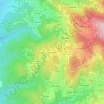
Name: Malmenaide topographic map, elevation, terrain.

Location: Malmenaide, Saint-Martin-des-Olmes, Ambert, Puy-de-Dôme, Auvergne-Rhône-Alpes, France métropolitaine, 63600, France (45.49687 3.77137 45.53687 3.81137)

Average elevation: 787 m

Minimum elevation: 574 m

Maximum elevation: 1,092 m

Other topographic maps

Click on a map to view its topography, its elevation and its terrain.

Gear up for your next adventure:

🔋Emergency Crank Radio - Weather alerts and power without needing batteries
🥾Mountain Hiking Shoes - Shoes with superior grip for mountainous terrain
🥾Durable Hiking Shoes - Long-lasting shoes for frequent hiking
Lightweight Camping Tent - Portable shelter optimized for Canadian backcountry camping
🥾Mountain Trail Shoes - High-traction shoes for mountain trails

As an Amazon Associate, this site earns from qualifying purchases at no extra cost to you.