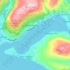
Ben Lomond topographic map
Click on the map to display elevation.
Ben Lomond
Douglas Fir forest was originally sown on the lower slopes of Cemetery Hill in the late 19th century as part of a beautification project led by a local pharmacist Louis Hotop. In the early to mid 20th century further plantings became part of the town's Arbor Day activities. Since the 1960s, following the culling of feral goats, which up to then had kept seedling-spread in check, they have rapidly grown and have been spreading quickly up and along Ben Lomond's slopes. The Department of Conservation did some control operations, but the responsibility has since passed on to the local council and various volunteer groups such Eco Action Network. These fir trees, although exotic, grow at a rate faster than in their original homeland of North America and create a monocultural forest devoid of the variety of native vegetation normally growing in the area. It has in some areas overtaken even mature beech forest. Control methods include: Hand pulling small seedlings, lopping the base of larger trees that are about one to three metres high, using chainsaws to chop down big tree above three metres in height, occasionally aerial spraying by helicopter is used in higher altitude areas that are hard to access by foot.
About this map

Name: Ben Lomond topographic map, elevation, terrain.
Average elevation: 1,243 m
Minimum elevation: 743 m
Maximum elevation: 1,729 m
Other topographic maps
Click on a map to view its topography, its elevation and its terrain.