Geolocate

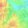
Les Pinauds topographic map

Click on the map to display elevation.

About this map

Name: Les Pinauds topographic map, elevation, terrain.

Location: Les Pinauds, Saintes, Charente-Maritime, Nouvelle-Aquitaine, France métropolitaine, 17100, France (45.71955 -0.69291 45.75955 -0.65291)

Average elevation: 50 m

Minimum elevation: 10 m

Maximum elevation: 84 m

Other topographic maps

Click on a map to view its topography, its elevation and its terrain.
Gear up for your next adventure:

🛶Waterproof Dry Bags - Keep electronics and clothes dry during river crossings
🧦Outdoor Socks - Durable socks designed for hiking and outdoor sports
🧦Hiking Socks - Moisture-wicking and comfortable socks for long hikes
💡Portable Camping Lamp - Rechargeable lamp for campsite lighting
🧦Merino Wool Socks - Moisture-wicking comfort for long-distance hiking

As an Amazon Associate, this site earns from qualifying purchases at no extra cost to you.