
Thank you for supporting this site ❤️
Make a donation
Make a donation
Gear up for your next adventure:
As an Amazon Associate, this site earns from qualifying purchases at no extra cost to you.
Rolleston topographic map
Click on the map to display elevation.
Thank you for supporting this site ❤️
Make a donation
Make a donation
Gear up for your next adventure:
As an Amazon Associate, this site earns from qualifying purchases at no extra cost to you.
About this map
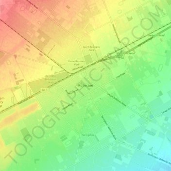
Name: Rolleston topographic map, elevation, terrain.
Location: Rolleston, Selwyn District, Canterbury, 7643, New Zealand (-43.63665 172.34500 -43.55665 172.42500)
Average elevation: 54 m
Minimum elevation: 22 m
Maximum elevation: 91 m
Thank you for supporting this site ❤️
Make a donation
Make a donation
Gear up for your next adventure:
As an Amazon Associate, this site earns from qualifying purchases at no extra cost to you.