Geolocate

Stafford topographic map

Click on the map to display elevation.

About this map

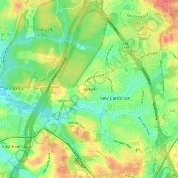
Name: Stafford topographic map, elevation, terrain.

Location: Stafford, East Riverdale, Prince George's County, Maryland, 20784, United States (38.95178 -76.90747 38.99178 -76.86747)

Average elevation: 42 m

Minimum elevation: 14 m

Maximum elevation: 74 m

Other topographic maps

Click on a map to view its topography, its elevation and its terrain.

Gear up for your next adventure:

🧥Softshell Hiking Jacket - The perfect balance of wind protection and breathability
Bushcraft Tarp - Versatile emergency shelter or gear protection
🌬️Windproof Camp Stove - Efficient cooking even on exposed mountain peaks
🥽Outdoor Goggles - Protective eyewear for outdoor activities
🥾Hiking Leggings - Comfortable leggings for outdoor activities

As an Amazon Associate, this site earns from qualifying purchases at no extra cost to you.