Geolocate

Maghnia topographic map

Click on the map to display elevation.

About this map
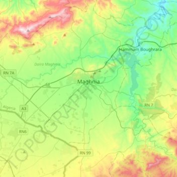
Name: Maghnia topographic map, elevation, terrain.

Location: Maghnia, Maghnia District, Tlemcen, Algeria (34.75638 -1.97452 34.91693 -1.66292)

Average elevation: 468 m

Minimum elevation: 199 m

Maximum elevation: 1,011 m

Gear up for your next adventure:

🥾Trail Running Boots - Durable shoes designed for trail running
🧢Outdoor Cap - Protective cap for sun and rain during hikes
🎒Fully Waterproof Backpack - Total protection for photography gear and electronics
⛺Family Camping Tent - Spacious tent suitable for family camping trips
💡Portable Camping Lamp - Rechargeable lamp for campsite lighting

As an Amazon Associate, this site earns from qualifying purchases at no extra cost to you.