Geolocate

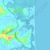
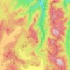
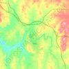
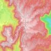
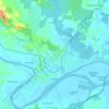
Mount Moombil topographic map

Click on the map to display elevation.

About this map

Name: Mount Moombil topographic map, elevation, terrain.

Location: Mount Moombil, Coffs Harbour City Council, New South Wales, Australia (-30.31704 152.85977 -30.31694 152.85987)

Average elevation: 755 m

Minimum elevation: 559 m

Maximum elevation: 1,031 m

Other topographic maps

Click on a map to view its topography, its elevation and its terrain.
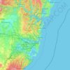
Sydney

Australia > New South Wales

Sydney's topography is characterized by a diverse landscape that seamlessly blends coastal features with inland plateaus. The city is divided into two primary regions: the relatively flat Cumberland Plain to the south and west of Sydney Harbour, and the elevated Hornsby Plateau to the north. The Cumberland…

Average elevation: 51 m

Tocumwal

Australia > New South Wales

Average elevation: 112 m

Bar Point

Australia > New South Wales

Average elevation: 76 m

Katoomba

Australia > New South Wales

Average elevation: 904 m

Mudgee

Australia > New South Wales

Average elevation: 535 m

Newcastle

Australia > New South Wales > Newcastle

Average elevation: 5 m

Bateau Bay

Australia > New South Wales > Gosford

Average elevation: 16 m

Barrington Tops National Park

Australia > New South Wales

The climate varies from temperate on the lower altitudes to subalpine at highest elevations. A record low of −17 °C (1 °F) has been registered at 1,500 m (4,900 ft) above mean sea level. Rainfalls fluctuate between 750 millimetres (30 in) in the northwest to more than 2,000 mm (79 in) in the southeast.

Average elevation: 736 m

Gulgong

Australia > New South Wales

Average elevation: 454 m

Moruya Heads

Australia > New South Wales

Average elevation: 9 m

Karangi

Australia > New South Wales

Average elevation: 173 m

Windsor

Australia > New South Wales

Average elevation: 12 m

Northern Beaches

Australia > New South Wales > Sydney

Average elevation: 67 m

Blue Mountains

Australia > New South Wales

A sandstone plateau dominated by a landscape of endless eucalyptus forests, the Blue Mountains are located at the top of a 470-million-year-old quartzite. In the Permian period, a shallow sea covered the region, when rivers brought shales, siltstones and mudstones. Then during the Mesozoic period, rivers…

Average elevation: 566 m
Parramatta

Australia > New South Wales

Average elevation: 22 m

Armidale

Australia > New South Wales

Average elevation: 1,036 m

Penrith

Australia > New South Wales > Sydney > Penrith

Penrith is a city in New South Wales, Australia, located in Greater Western Sydney, 55 kilometres (31 mi) west of the Sydney central business district on the banks of the Nepean River, on the outskirts of the Cumberland Plain. Its elevation is 32 metres (105 ft).

Average elevation: 34 m

Bankstown

Australia > New South Wales > Sydney

Average elevation: 34 m

Manly

Australia > New South Wales

Average elevation: 17 m

Ocean Shores

Australia > New South Wales

Average elevation: 12 m

Drake

Australia > New South Wales

Average elevation: 505 m

Burramoko Ridge

Australia > New South Wales

Average elevation: 920 m

Urunga

Australia > New South Wales

Average elevation: 13 m

Barrington Tops

Australia > New South Wales

Average elevation: 1,107 m

Byron Bay

Australia > New South Wales

Byron Bay, located in northeastern New South Wales, Australia, is characterized by diverse topography shaped by its geological history. The town is part of the erosion caldera of the ancient Tweed Volcano, which erupted approximately 23 million years ago, resulting in the rich volcanic soils that define the…

Average elevation: 7 m
Mittagong

Australia > New South Wales

Average elevation: 672 m

Avoca Beach

Australia > New South Wales

Average elevation: 23 m

Wauchope

Australia > New South Wales

Average elevation: 32 m

Wentworth Falls

Australia > New South Wales > Sydney

Wentworth Falls (postcode: 2782) is a town in the Blue Mountains region of New South Wales, situated approximately 100 kilometres (62 mi) west of the Sydney central business district, and about 8 kilometres (5.0 mi) east of Katoomba, Australia on the Great Western Highway, with a Wentworth Falls railway…

Average elevation: 708 m
Nimmitabel

Australia > New South Wales

Average elevation: 1,051 m

Tweed Shire Council

Australia > New South Wales

Average elevation: 212 m

Kellyville

Australia > New South Wales

Average elevation: 70 m

Lismore

Australia > New South Wales

Average elevation: 23 m

Riverside

Australia > New South Wales

Average elevation: 3 m

Buff Point

Australia > New South Wales

Average elevation: 9 m

Tenterfield

Australia > New South Wales

Average elevation: 891 m

Nobbys Creek

Australia > New South Wales

Average elevation: 66 m

Moonbi

Australia > New South Wales

Average elevation: 790 m

Ellalong

Australia > New South Wales

Average elevation: 162 m

Cudgera Creek

Australia > New South Wales

Average elevation: 43 m

Mumbil

Australia > New South Wales

Average elevation: 415 m

Devils Hole

Australia > New South Wales

Average elevation: 470 m

Hyland Park

Australia > New South Wales

Average elevation: 8 m

Moruya

Australia > New South Wales

Average elevation: 37 m

Sawyers Gully

Australia > New South Wales

Average elevation: 56 m

Scotts Head

Australia > New South Wales

Average elevation: 5 m

Port Macquarie

Australia > New South Wales

Average elevation: 5 m

Chatswood

Australia > New South Wales

Average elevation: 81 m

St Ives

Australia > New South Wales > Sydney

Average elevation: 125 m

Woolgoolga

Australia > New South Wales

Average elevation: 29 m

Maroubra

Australia > New South Wales

Average elevation: 27 m

Wagga Wagga

Australia > New South Wales

Average elevation: 183 m

Dubbo

Australia > New South Wales

Average elevation: 318 m

Carabost

Australia > New South Wales

Average elevation: 484 m

Ulong

Australia > New South Wales

Average elevation: 559 m

Booral

Australia > New South Wales

Average elevation: 98 m

Four Mile Creek

Australia > New South Wales

Average elevation: 831 m

Akolele

Australia > New South Wales

Average elevation: 15 m

Bimberi

Australia > New South Wales

Average elevation: 1,317 m

Paxton

Australia > New South Wales

Average elevation: 125 m

Swan Bay

Australia > New South Wales

Average elevation: 5 m

Scotland Island

Australia > New South Wales > Sydney

Average elevation: 17 m

Bowral

Australia > New South Wales

Average elevation: 690 m

Campbelltown

Australia > New South Wales

Average elevation: 96 m

Singleton Council

Australia > New South Wales

Average elevation: 238 m

Yass

Australia > New South Wales

Yass is located 280 km south-west of Sydney, on the Hume Highway. The Yass River, which is a tributary of the Murrumbidgee River, flows through the town. Yass is 59 km from Canberra; lying at an elevation of 505 m AMSL.

Average elevation: 533 m
Goulburn

Australia > New South Wales

Owing to its elevation, Goulburn has an oceanic climate (Cfb) with warm summers and cool winters; with a high diurnal range. Its climate is variable much of the year, though generally dry with maximum temperatures ranging from 11.8 °C (53.2 °F) in July to 28.3 °C (82.9 °F) in January. Rainfall is…

Average elevation: 666 m

Alstonville

Australia > New South Wales

Average elevation: 131 m

Baulkham Hills

Australia > New South Wales > Sydney

Average elevation: 93 m

Casino

Australia > New South Wales

Average elevation: 32 m

Glen Innes

Australia > New South Wales

Average elevation: 1,083 m

Nowra

Australia > New South Wales

Average elevation: 21 m

Mullumbimby

Australia > New South Wales

Average elevation: 29 m

Blackheath

Australia > New South Wales

Blackheath (postcode: 2785) is an Australian town located near the highest point of the Blue Mountains, between Katoomba and Mount Victoria in New South Wales. The town's altitude is about 1,065 metres (3,494 ft) AHD  and it is located about 120 kilometres (75 mi) west north-west of Sydney, 11 kilometres…

Average elevation: 893 m

Kurnell

Australia > New South Wales > Sydney

Average elevation: 4 m

Moss Vale

Australia > New South Wales

Average elevation: 673 m

Terrey Hills

Australia > New South Wales > Sydney

Owing to its elevation and close proximity to the ocean, as well as its extensive tree canopy cover, the weather station at Terrey Hills records the mildest temperatures of any weather station in the Greater Sydney region. Under Köppen's scheme, the suburb has a borderline humid subtropical (Cfa) and oceanic…

Average elevation: 146 m

Avalon Beach

Australia > New South Wales

Average elevation: 24 m

Moree

Australia > New South Wales

Average elevation: 216 m

Taree

Australia > New South Wales

Average elevation: 17 m

Epping

Australia > New South Wales > Sydney

Average elevation: 96 m

Gear up for your next adventure:

💧Collapsible Water Bottle - Space-saving water bottle for outdoor activities
👖Convertible Hiking Pants - Zip-off legs to adapt to changing weather conditions
👟Trail Running Shoes - Agile footwear for fast-paced topographic exploration
🧢Sun Hat - Wide-brim hat for sun protection
🏃Hydration Running Vest - Carry water and maps close to your body for speed

As an Amazon Associate, this site earns from qualifying purchases at no extra cost to you.