
Thank you for supporting this site ❤️
Make a donation
Make a donation
Gear up for your next adventure:
As an Amazon Associate, this site earns from qualifying purchases at no extra cost to you.
Cheongwon-gu topographic map
Click on the map to display elevation.
Thank you for supporting this site ❤️
Make a donation
Make a donation
Gear up for your next adventure:
As an Amazon Associate, this site earns from qualifying purchases at no extra cost to you.
About this map
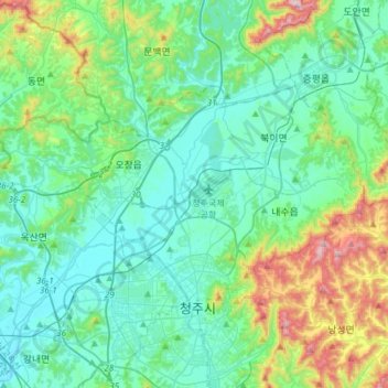
Name: Cheongwon-gu topographic map, elevation, terrain.
Location: Cheongwon-gu, Cheongju-si, North Chungcheong, South Korea (36.64480 127.31790 36.78026 127.61874)
Average elevation: 135 m
Minimum elevation: 20 m
Maximum elevation: 577 m
Thank you for supporting this site ❤️
Make a donation
Make a donation
Gear up for your next adventure:
As an Amazon Associate, this site earns from qualifying purchases at no extra cost to you.