
Thank you for supporting this site ❤️
Make a donation
Make a donation
Gear up for your next adventure:
As an Amazon Associate, this site earns from qualifying purchases at no extra cost to you.
Taghit topographic map
Click on the map to display elevation.
Thank you for supporting this site ❤️
Make a donation
Make a donation
Gear up for your next adventure:
As an Amazon Associate, this site earns from qualifying purchases at no extra cost to you.
About this map
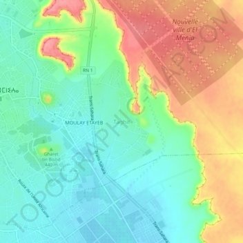
Name: Taghit topographic map, elevation, terrain.
Location: Taghit, El Menia, Daïra El Menia, El Meniaa, 47001, Algérie (30.55916 2.88788 30.59916 2.92788)
Average elevation: 414 m
Minimum elevation: 379 m
Maximum elevation: 470 m
Thank you for supporting this site ❤️
Make a donation
Make a donation
Gear up for your next adventure:
As an Amazon Associate, this site earns from qualifying purchases at no extra cost to you.