Geolocate

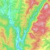
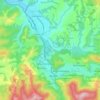
Vodnic topographic map

Click on the map to display elevation.

About this map
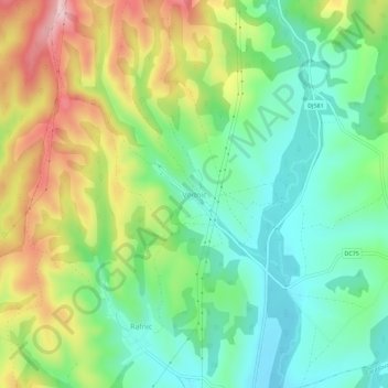
Name: Vodnic topographic map, elevation, terrain.

Location: Vodnic, Lupac, Caraș-Severin, 327258, Romania (45.22676 21.77615 45.26676 21.81615)

Average elevation: 267 m

Minimum elevation: 178 m

Maximum elevation: 416 m

Other topographic maps

Click on a map to view its topography, its elevation and its terrain.

Grădinari

Romania > Caraș-Severin

Average elevation: 144 m

Băile Herculane

Romania > Caraș-Severin

Băile Herculane (Latin: Aqua Herculis; German: Herkulesbad; Hungarian: Herkulesfürdő; Czech: Herkulovy Lázně, Turkish: Lazarethane, English: Herculean Baths) is a spa town in Romanian Banat, in Caraș-Severin County, situated in the valley of the Cerna River, between the Mehedinți Mountains to the east…

Average elevation: 571 m

Ticvaniu Mare

Romania > Caraș-Severin

Average elevation: 201 m

Caransebeș

Romania > Caraș-Severin

Average elevation: 256 m

Putna

Romania > Caraș-Severin

Average elevation: 544 m

Mehadia

Romania > Caraș-Severin

Mehadia is located in southwestern Romania in the Cerna valley at an elevation of 287 m (942 ft). It is located along European route E70, south of the village of Plugova and north of Topleț. Beyond Topleț to the south is Orșova, which was for many years the residence of a Pasha and contained a prominent…

Average elevation: 613 m

Caransebeș

Romania > Caraș-Severin

Average elevation: 229 m

Gârnic

Romania > Caraș-Severin

Average elevation: 501 m

Teregova

Romania > Caraș-Severin

The commune is located in the east-central part of county, stretching eastwards to the border with Hunedoara County. It is situated at an altitude of 424 m (1,391 ft), at the foot of the Țarcu Mountains. The river Timiș flows through Rusca village; its right tributary, the river Teregova, joins the Timiș in…

Average elevation: 803 m

Băile Herculane

Romania > Caraș-Severin

Băile Herculane (Latin: Aqua Herculis; German: Herkulesbad; Hungarian: Herkulesfürdő; Czech: Herkulovy Lázně, Turkish: Lazarethane) is a spa town in Romanian Banat, in Caraș-Severin County, situated in the valley of the Cerna River, between the Mehedinți Mountains to the east and the Cerna Mountains to…

Average elevation: 571 m
Reșița

Romania > Caraș-Severin

Average elevation: 381 m

Reșița

Romania > Caraș-Severin > Reșița

Average elevation: 307 m

Brebu Nou

Romania > Caraș-Severin

Average elevation: 922 m

Bozovici

Romania > Caraș-Severin

Average elevation: 668 m

Slatina-Nera

Romania > Caraș-Severin

Average elevation: 209 m

Zlatița

Romania > Caraș-Severin

Average elevation: 121 m

Văliug

Romania > Caraș-Severin

Average elevation: 855 m

Oravița

Romania > Caraș-Severin

Average elevation: 302 m

Gărâna

Romania > Caraș-Severin

Average elevation: 949 m

Lăpușnicu Mare

Romania > Caraș-Severin

Average elevation: 487 m

Oravița

Romania > Caraș-Severin

Average elevation: 302 m

Ciclova Montană

Romania > Caraș-Severin > Oravița

Average elevation: 365 m

Iablanița

Romania > Caraș-Severin

Average elevation: 542 m

Carașova

Romania > Caraș-Severin

Average elevation: 456 m

Marga

Romania > Caraș-Severin

Average elevation: 707 m

Pojejena

Romania > Caraș-Severin

Average elevation: 238 m

Socol

Romania > Caraș-Severin

Average elevation: 128 m

Cărbunari

Romania > Caraș-Severin

Average elevation: 493 m

Gear up for your next adventure:

🕯️Camping Lantern - Illuminates your entire campsite with high-efficiency LEDs
🥾All-Terrain Hiking Boots - Versatile boots for varied hiking conditions
💧Collapsible Water Bottle - Space-saving water bottle for outdoor activities
🥾Trail Running Boots - Durable shoes designed for trail running
👟Sport Hiking Sandals - Breathable footwear for water crossings and camp rest

As an Amazon Associate, this site earns from qualifying purchases at no extra cost to you.