Geolocate

Magnus topographic map

Click on the map to display elevation.

About this map

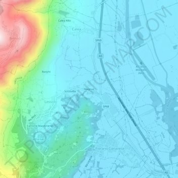
Name: Magnus topographic map, elevation, terrain.

Location: Magnus, Lessolo, Torino, Piedmont, 10010, Italy (45.46111 7.80703 45.50111 7.84703)

Average elevation: 334 m

Minimum elevation: 237 m

Maximum elevation: 859 m

Gear up for your next adventure:

🥾Trail Hiking Boots - Supportive boots for rough trails
🧥Packable Rain Jacket - Breathable waterproof layer for unpredictable weather
🧶550 Survival Paracord - Versatile utility cord for emergency repairs and rigging
👟Sport Hiking Sandals - Breathable footwear for water crossings and camp rest
🔭Outdoor Binoculars - Lightweight binoculars for birdwatching and hiking

As an Amazon Associate, this site earns from qualifying purchases at no extra cost to you.