Geolocate

Gembor topographic map

Click on the map to display elevation.

About this map

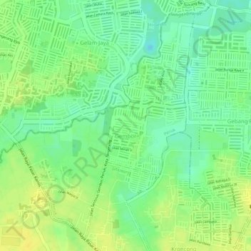
Name: Gembor topographic map, elevation, terrain.

Location: Gembor, Periuk, Tangerang, Banten, 11513, Indonesia (-6.18646 106.56713 -6.16222 106.58641)

Average elevation: 14 m

Minimum elevation: -1 m

Maximum elevation: 24 m

Other topographic maps

Click on a map to view its topography, its elevation and its terrain.

East Asia

Indonesia > Banten > Tangerang

Average elevation: 12 m

West Europe

Indonesia > Banten > Tangerang

Average elevation: 9 m

East Asia

Indonesia > Banten > Tangerang

Average elevation: 12 m

Gear up for your next adventure:

Tent Footprint - Protect tent floor and increase durability
🧦Crew Hiking Socks - Comfortable socks for long-distance hikes
🥾Hiking Boots - Sturdy boots providing ankle support and traction on rugged trails
🧼Travel Hand Sanitizer - Keep hands clean when water is scarce
🍽️Titanium Camping Spork - Ultralight and indestructible eating utensil

As an Amazon Associate, this site earns from qualifying purchases at no extra cost to you.