Geolocate

Balmoral topographic map

Click on the map to display elevation.

About this map

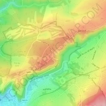
Name: Balmoral topographic map, elevation, terrain.

Location: Balmoral, Spa, Verviers, Liège, Wallonia, 4900, Belgium (50.48391 5.86453 50.52391 5.90453)

Average elevation: 336 m

Minimum elevation: 241 m

Maximum elevation: 462 m

Gear up for your next adventure:

🧭GPS Tracker - Track your location in remote areas safely
🩹Compact First Aid Kit - Pre-packed essentials for common trail injuries
🚑Survival Whistle - Signal for help across long distances in mountains
🛏️Sleeping Bag - Warm and compact sleeping bags for outdoor camping
🧭Orienteering Kit - Tools for map reading and navigation in the wild

As an Amazon Associate, this site earns from qualifying purchases at no extra cost to you.