
Thank you for supporting this site ❤️
Make a donation
Make a donation
Gear up for your next adventure:
As an Amazon Associate, this site earns from qualifying purchases at no extra cost to you.
El Hassana Dome Protectorate topographic map
Click on the map to display elevation.
Thank you for supporting this site ❤️
Make a donation
Make a donation
Gear up for your next adventure:
As an Amazon Associate, this site earns from qualifying purchases at no extra cost to you.
About this map
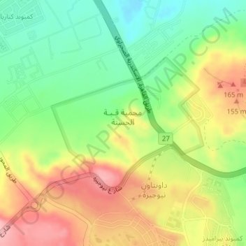
Name: El Hassana Dome Protectorate topographic map, elevation, terrain.
Location: El Hassana Dome Protectorate, Sheikh Zayed, Giza, Egypt (30.02039 31.05032 30.03498 31.06972)
Average elevation: 108 m
Minimum elevation: 40 m
Maximum elevation: 188 m
Thank you for supporting this site ❤️
Make a donation
Make a donation
Gear up for your next adventure:
As an Amazon Associate, this site earns from qualifying purchases at no extra cost to you.