
Δημοτική Ενότητα Διστόμου topographic map
Interactive map
Click on the map to display elevation.
About this map
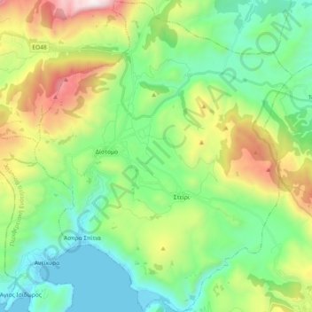
Name: Δημοτική Ενότητα Διστόμου topographic map, elevation, terrain.
Average elevation: 571 m
Minimum elevation: 0 m
Maximum elevation: 1,890 m
Other topographic maps
Click on a map to view its topography, its elevation and its terrain.
Agios Georgios
Grèce > Thessalie-Grèce centrale > Περιφερειακή Ενότητα Βοιωτίας
Agios Georgios, Δήμος Λεβαδέων, Περιφερειακή Ενότητα Βοιωτίας, Grèce-Centrale, Thessalie-Grèce centrale, 320 07, Grèce
Average elevation: 279 m