
Thank you for supporting this site ❤️
Make a donation
Make a donation
Gear up for your next adventure:
As an Amazon Associate, this site earns from qualifying purchases at no extra cost to you.
Sinseong-dong topographic map
Click on the map to display elevation.
Thank you for supporting this site ❤️
Make a donation
Make a donation
Gear up for your next adventure:
As an Amazon Associate, this site earns from qualifying purchases at no extra cost to you.
About this map
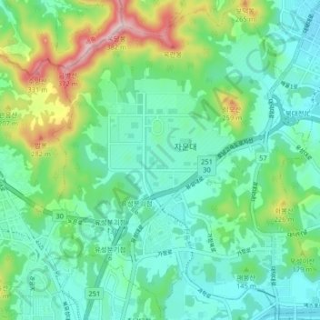
Name: Sinseong-dong topographic map, elevation, terrain.
Location: Sinseong-dong, Yuseong-gu, Daejeon, South Korea (36.37181 127.32275 36.43558 127.40314)
Average elevation: 111 m
Minimum elevation: 27 m
Maximum elevation: 353 m
Thank you for supporting this site ❤️
Make a donation
Make a donation
Gear up for your next adventure:
As an Amazon Associate, this site earns from qualifying purchases at no extra cost to you.