
Kilakkarai topographic map
Click on the map to display elevation.
About this map
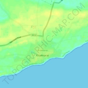
Name: Kilakkarai topographic map, elevation, terrain.
Location: Kilakkarai, Ramanathapuram, Tamil Nadu, 623517, India (9.19067 78.74428 9.27067 78.82428)
Average elevation: 5 m
Minimum elevation: -1 m
Maximum elevation: 23 m
Other topographic maps
Click on a map to view its topography, its elevation and its terrain.
Ramanathapuram
India > Tamil Nadu > Ramanathapuram
Ramanathapuram is located at 9°23′N 78°50′E / 9.38°N 78.83°E / 9.38; 78.83. It has an average elevation of 2 metres (6 feet). The nearest towns include Paramakudi, Rameshwaram, Mudukulathur, Kilakarai and Manamadurai.
Average elevation: 7 m