
Make a donation
Gear up for your next adventure:
As an Amazon Associate, this site earns from qualifying purchases at no extra cost to you.
Ocracoke topographic map
Click on the map to display elevation.
Make a donation
Gear up for your next adventure:
As an Amazon Associate, this site earns from qualifying purchases at no extra cost to you.
About this map
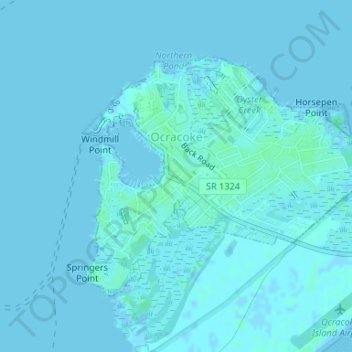
Name: Ocracoke topographic map, elevation, terrain.
Location: Ocracoke, Hyde County, North Carolina, 27960, United States (35.10234 -75.98994 35.12078 -75.96104)
Average elevation: 1 m
Minimum elevation: -2 m
Maximum elevation: 5 m
Make a donation
Gear up for your next adventure:
As an Amazon Associate, this site earns from qualifying purchases at no extra cost to you.
Other topographic maps
Click on a map to view its topography, its elevation and its terrain.
Swan Quarter
United States > North Carolina > Hyde County
Swan Quarter is in western Hyde County at latitude 35.405 N and longitude 76.331 W. The elevation is 3 feet (0.91 m) above sea level. It is located on Swanquarter Bay, an inlet of Pamlico Sound.
Average elevation: 2 m