Geolocate

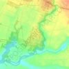
Tumpang topographic map

Click on the map to display elevation.

About this map

Name: Tumpang topographic map, elevation, terrain.

Location: Tumpang, Kabupaten Malang, East Java, 65156, Indonesia (-8.04676 112.72155 -7.96676 112.80155)

Average elevation: 618 m

Minimum elevation: 465 m

Maximum elevation: 847 m

Other topographic maps

Click on a map to view its topography, its elevation and its terrain.
Pulau Sempu

Indonesia > East Java > Kabupaten Malang

Average elevation: 26 m

Tegalsari

Indonesia > East Java > Kabupaten Malang

Average elevation: 317 m

Pulau Sempu

Indonesia > East Java > Kabupaten Malang

Average elevation: 26 m

Gear up for your next adventure:

🧢Outdoor Visor - Breathable visor for sunny hikes
🧢Hiking Sun Hat - Wide-brimmed protection for exposed mountain ridges
🥾Approach Shoes - Shoes designed for climbing approaches and rugged trails
🧣Merino Neck Gaiter - Protects against wind, sun, and cold at high altitudes
🔭Compact Monocular - One-handed bird watching and trail spotting

As an Amazon Associate, this site earns from qualifying purchases at no extra cost to you.