Geolocate

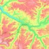
Longueval topographic map

Click on the map to display elevation.

About this map

Name: Longueval topographic map, elevation, terrain.

Location: Longueval, Péronne, Somme, Hauts-de-France, Metropolitan France, 80360, France (50.00636 2.77675 50.05137 2.82568)

Average elevation: 141 m

Minimum elevation: 101 m

Maximum elevation: 163 m

Other topographic maps

Click on a map to view its topography, its elevation and its terrain.

Petit-Camon

France > Hauts-de-France > Somme > Camon

Average elevation: 73 m

Amiens

France > Hauts-de-France > Somme > Amiens

Average elevation: 86 m

Larronville

France > Hauts-de-France > Somme > Rue

Average elevation: 8 m

Gear up for your next adventure:

🧤Insulated Winter Gloves - Heavy-duty protection for sub-zero Canadian adventures
🧰Emergency Multi-Tool - Compact multi-tool for outdoor survival
🧴Waterproofing Spray - Restore the DWR coating on jackets and tents
🥾Light Hiking Boots - Lightweight and comfortable boots for day hikes
🧤Rechargeable Heated Gloves - Extreme warmth for Canadian winter expeditions

As an Amazon Associate, this site earns from qualifying purchases at no extra cost to you.