Geolocate

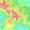
Altıntepe topographic map

Click on the map to display elevation.

About this map

Name: Altıntepe topographic map, elevation, terrain.

Location: Altıntepe, Haliliye, Şanlıurfa, Southeastern Anatolia Region, 63050, Turkey (37.10081 38.88419 37.14081 38.92419)

Average elevation: 447 m

Minimum elevation: 428 m

Maximum elevation: 470 m

Other topographic maps

Click on a map to view its topography, its elevation and its terrain.

Oğulbey Mahallesi

Turkey > Haliliye

Average elevation: 474 m

Göbekli Tepe

Turkey > Haliliye > Örencik Mahallesi

Average elevation: 702 m

Göbekli Tepe

Turkey > Haliliye > Örencik Mahallesi

Average elevation: 702 m

Anaz Mahallesi

Turkey > Haliliye

Average elevation: 464 m

Göbekli Tepe

Turkey > Haliliye > Örencik Mahallesi

Average elevation: 702 m

Örencik Mahallesi

Turkey > Haliliye

Average elevation: 665 m

Gear up for your next adventure:

💧Collapsible Water Bottle - Space-saving water bottle for outdoor activities
🧥Ultralight Puffy Jacket - Maximum warmth that packs down to the size of an orange
🥾Waterproof Hiking Boots - Boots keeping your feet dry in wet conditions
🧥Thermal Fleece Jacket - Versatile insulation for changing mountain temperatures
🥾All-Terrain Hiking Boots - Versatile boots for varied hiking conditions

As an Amazon Associate, this site earns from qualifying purchases at no extra cost to you.