Geolocate

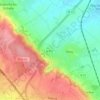
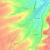
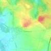
Radinghem topographic map

Click on the map to display elevation.

About this map

Name: Radinghem topographic map, elevation, terrain.

Location: Radinghem, Montreuil-sur-Mer, Pas-de-Calais, Hauts-de-France, Metropolitan France, 62310, France (50.53609 2.09477 50.55767 2.13876)

Average elevation: 124 m

Minimum elevation: 73 m

Maximum elevation: 173 m

Other topographic maps

Click on a map to view its topography, its elevation and its terrain.

Panehem

France > Hauts-de-France > Pas-de-Calais > Samer

Average elevation: 70 m

Le Petit Vimy

France > Hauts-de-France > Pas-de-Calais > Vimy

Average elevation: 93 m

Noyelles

France > Hauts-de-France > Pas-de-Calais > Bours

Average elevation: 125 m

Gear up for your next adventure:

🕯️Camping Lantern - Illuminates your entire campsite with high-efficiency LEDs
🕶️Polarized Sunglasses - Protect your eyes with durable polarized lenses
🥾Waterproof Trail Shoes - Shoes designed to handle wet terrain
🚲Heavy Duty Bike Lock - Secure your bike at the trailhead or during stops
🥾Lightweight Hiking Boots - Boots for comfort and mobility on long hikes

As an Amazon Associate, this site earns from qualifying purchases at no extra cost to you.