Geolocate

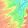
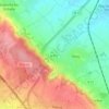
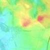
Hernicourt topographic map

Click on the map to display elevation.

About this map

Name: Hernicourt topographic map, elevation, terrain.

Location: Hernicourt, Arras, Pas-de-Calais, Hauts-de-France, Metropolitan France, 62130, France (50.39000 2.26612 50.43205 2.34151)

Average elevation: 110 m

Minimum elevation: 62 m

Maximum elevation: 156 m

Other topographic maps

Click on a map to view its topography, its elevation and its terrain.

Panehem

France > Hauts-de-France > Pas-de-Calais > Samer

Average elevation: 70 m

Noyelles

France > Hauts-de-France > Pas-de-Calais > Bours

Average elevation: 125 m

Le Petit Vimy

France > Hauts-de-France > Pas-de-Calais > Vimy

Average elevation: 93 m

Gear up for your next adventure:

🧥Waterproof Pants - Keep dry during rainy hiking conditions
🔋Emergency Crank Radio - Weather alerts and power without needing batteries
🩹Moleskin Blister Pads - Direct protection for painful foot pressure points
🧳Compression Sacks - Maximize space in your backpack by shrinking gear
🥾Lightweight Hiking Shoes - Comfortable shoes for day hikes

As an Amazon Associate, this site earns from qualifying purchases at no extra cost to you.