Geolocate

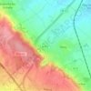
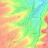
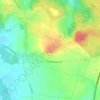
Ledinghem topographic map

Click on the map to display elevation.

About this map

Name: Ledinghem topographic map, elevation, terrain.

Location: Ledinghem, Saint-Omer, Pas-de-Calais, Hauts-de-France, Metropolitan France, 62380, France (50.63054 1.93721 50.66122 2.00738)

Average elevation: 161 m

Minimum elevation: 92 m

Maximum elevation: 205 m

Other topographic maps

Click on a map to view its topography, its elevation and its terrain.

Panehem

France > Hauts-de-France > Pas-de-Calais > Samer

Average elevation: 70 m

Le Petit Vimy

France > Hauts-de-France > Pas-de-Calais > Vimy

Average elevation: 93 m

Noyelles

France > Hauts-de-France > Pas-de-Calais > Bours

Average elevation: 125 m

Gear up for your next adventure:

🧭GPS Tracker - Track your location in remote areas safely
🥾Trekking Boots - Durable boots for long-distance trekking
💧Reusable Water Bottle - Durable water bottles for hydration on trails
🥾Mountain Hiking Shoes - Shoes with superior grip for mountainous terrain
🛏️Camping Sleeping Mat - Comfortable mats for sleeping outdoors

As an Amazon Associate, this site earns from qualifying purchases at no extra cost to you.