
Lago Mascardi topographic map
Interactive map
Click on the map to display elevation.
About this map
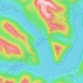
Name: Lago Mascardi topographic map, elevation, terrain.
Average elevation: 1,090 m
Minimum elevation: 796 m
Maximum elevation: 2,038 m
Other topographic maps
Click on a map to view its topography, its elevation and its terrain.
Las Dunas
Argentina > Río Negro > San Antonio Oeste
Las Dunas, San Antonio Oeste, Departamento San Antonio, Río Negro, Argentina
Average elevation: 9 m
General Roca
General Roca, Departamento General Roca, Río Negro, Argentina
Average elevation: 319 m
San Carlos de Bariloche
Argentina > Río Negro > San Carlos de Bariloche
San Carlos de Bariloche, Departamento Bariloche, Río Negro, 8400, Argentina
Average elevation: 913 m
Lago Gutiérrez
Lago Gutiérrez, Ruta Nacional 40, Villa Lago Gutiérrez, Departamento Bariloche, Río Negro, 8400, Argentina
Average elevation: 1,175 m