Geolocate

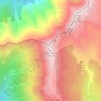
Cima Portule topographic map

Click on the map to display elevation.

Cima Portule

Cima Portule is a mountain in Italy, located in the province of Vicenza in the Veneto region. It has an elevation of 2,308 metres (7,572 ft).

Wikipedia (CC-BY-SA 3.0)

About this map

Name: Cima Portule topographic map, elevation, terrain.

Location: Cima Portule, Asiago, Vicenza, Veneto, 36012, Italy (45.97914 11.44714 45.97924 11.44724)

Average elevation: 1,938 m

Minimum elevation: 1,366 m

Maximum elevation: 2,313 m

Gear up for your next adventure:

🥾Waterproof Hiking Shoes - Durable shoes for wet and rugged trails
🧤Rechargeable Heated Gloves - Extreme warmth for Canadian winter expeditions
🧥Packable Rain Jacket - Breathable waterproof layer for unpredictable weather
💧Hydration Bladder - Hands-free hydration solution for long treks
🧦Outdoor Socks - Durable socks designed for hiking and outdoor sports

As an Amazon Associate, this site earns from qualifying purchases at no extra cost to you.