Geolocate

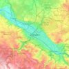
01465 topographic map

Click on the map to display elevation.

About this map

Name: 01465 topographic map, elevation, terrain.

Location: 01465, Langebrück, Dresden, Saxony, Germany (51.10656 13.81637 51.15811 13.88927)

Average elevation: 227 m

Minimum elevation: 176 m

Maximum elevation: 282 m

Other topographic maps

Click on a map to view its topography, its elevation and its terrain.
Dresden

Germany > Saxony > Dresden

Average elevation: 237 m

Hammerbach-Seitenquelle

Germany > Saxony > Dresden

Average elevation: 273 m

Gear up for your next adventure:

⛺Lightweight Camping Tent - Portable shelter optimized for Canadian backcountry camping
🧢Beanie Hat - Keep your head warm in cold weather
🧊Insulated Water Bottle - Keeps drinks cold in summer and prevents freezing in winter
🔭Compact Binoculars - Lightweight optics for scouting trails and wildlife
💧Hydration Pack - Hands-free hydration system for long hikes

As an Amazon Associate, this site earns from qualifying purchases at no extra cost to you.