Geolocate

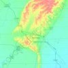
Caraway topographic map

Click on the map to display elevation.

About this map

Name: Caraway topographic map, elevation, terrain.

Location: Caraway, Craighead County, Arkansas, 72419, United States (35.73683 -90.35791 35.78769 -90.28721)

Average elevation: 69 m

Minimum elevation: 66 m

Maximum elevation: 72 m

Other topographic maps

Click on a map to view its topography, its elevation and its terrain.

Gear up for your next adventure:

🥾Mountain Hiking Boots - High-traction boots for rocky terrain
🧴Insect Repellent - Protect yourself from bugs during outdoor adventures
🧢Hiking Hat - Sun-protective and breathable hats for long treks
🧤Thermal Hiking Gloves - Grip-enhanced gloves for cold-weather altitude trekking
🥾Trail Running Shoes - Lightweight and durable shoes for trail running

As an Amazon Associate, this site earns from qualifying purchases at no extra cost to you.