Geolocate

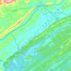
Conasauga Heights topographic map

Click on the map to display elevation.

About this map

Name: Conasauga Heights topographic map, elevation, terrain.

Location: Conasauga Heights, Oak Ridge, Anderson County, East Tennessee, Tennessee, 37831, United States (36.01175 -84.21909 36.05175 -84.17909)

Average elevation: 274 m

Minimum elevation: 196 m

Maximum elevation: 364 m

Other topographic maps

Click on a map to view its topography, its elevation and its terrain.
Gear up for your next adventure:

🔦LED Headlamp - Hands-free lighting for early morning starts or late finishes
⛺Camping Groundsheet - Protect your tent from moisture and dirt
🏃Hydration Running Vest - Carry water and maps close to your body for speed
🏕️Camping Hammock - Integrated protection for sleeping between trees
🥾Light Hiking Boots - Lightweight and comfortable boots for day hikes

As an Amazon Associate, this site earns from qualifying purchases at no extra cost to you.