Geolocate

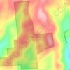
Snowdon topographic map

Click on the map to display elevation.

About this map

Name: Snowdon topographic map, elevation, terrain.

Location: Snowdon, Town of Otsego, Otsego County, New York, 13348, United States (42.71257 -75.08321 42.75257 -75.04321)

Average elevation: 530 m

Minimum elevation: 423 m

Maximum elevation: 623 m

Other topographic maps

Click on a map to view its topography, its elevation and its terrain.

City of Oneonta

United States > New York > Otsego County

Average elevation: 433 m

Town of Oneonta

United States > New York > Otsego County

Average elevation: 456 m

City of Oneonta

United States > New York > Otsego County

Average elevation: 433 m

City of Oneonta

United States > New York > Otsego County

Average elevation: 433 m

Town of Otego

United States > New York > Otsego County

Average elevation: 453 m

Gear up for your next adventure:

🧼Travel Hand Sanitizer - Keep hands clean when water is scarce
🥾Light Hiking Boots - Lightweight and comfortable boots for day hikes
🔋Lithium AA Batteries - Long-lasting power that performs in extreme cold
🥾Hiking Gaiters - Protect legs and shoes from mud, snow, and debris
🧦Hiking Socks - Moisture-wicking and comfortable socks for long hikes

As an Amazon Associate, this site earns from qualifying purchases at no extra cost to you.