Geolocate

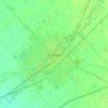
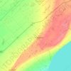
Morpeth topographic map

Click on the map to display elevation.

About this map

Name: Morpeth topographic map, elevation, terrain.

Location: Morpeth, Chatham-Kent, Southwestern Ontario, Ontario, N0P 1X0, Canada (42.37300 -81.86303 42.41300 -81.82303)

Average elevation: 202 m

Minimum elevation: 171 m

Maximum elevation: 226 m

Chatham-Kent trails, hiking, mountain biking, running and outdoor activities

Other topographic maps

Click on a map to view its topography, its elevation and its terrain.
Bothwell

Canada > Ontario > Chatham-Kent

Average elevation: 207 m

Thamesville

Canada > Ontario > Chatham-Kent

Average elevation: 188 m

Chatham

Canada > Ontario > Chatham-Kent

Average elevation: 182 m

Blythe Park

Canada > Ontario > Chatham-Kent > Chatham

Average elevation: 182 m

Harwich

Canada > Ontario > Chatham-Kent > Chatham

Average elevation: 189 m

Howard

Canada > Ontario > Chatham-Kent > Morpeth

Average elevation: 198 m

Chatham

Canada > Ontario > Chatham-Kent

In 1790, pioneer surveyor Patrick McNiff departed from Lake St. Clair and travelled upstream along the Thames River to survey the lands that would, in 1792, become Kent County. During this voyage, McNiff found that some 28 families had already established themselves in the region, suggesting the date of the…

Average elevation: 182 m

Chatham

Canada > Ontario > Chatham-Kent

Average elevation: 182 m

Gear up for your next adventure:

🧢Outdoor Visor - Breathable visor for sunny hikes
💧Filtered Water Bottle - Safe drinking water on the go
🥾Trail Running Shoes - Lightweight and durable shoes for trail running
🧭Orienteering Kit - Tools for map reading and navigation in the wild
🧶550 Survival Paracord - Versatile utility cord for emergency repairs and rigging

As an Amazon Associate, this site earns from qualifying purchases at no extra cost to you.