Geolocate

Peapully topographic map

Click on the map to display elevation.

About this map

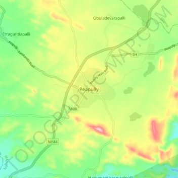
Name: Peapully topographic map, elevation, terrain.

Location: Peapully, Peapally, Nandyal District, Andhra Pradesh, India (15.19495 77.69908 15.27495 77.77908)

Average elevation: 507 m

Minimum elevation: 404 m

Maximum elevation: 656 m

Gear up for your next adventure:

🧤Rechargeable Heated Gloves - Extreme warmth for Canadian winter expeditions
🧴Outdoor Sunscreen - High SPF protection for high-altitude UV exposure
🧰Multitool Knife - Compact and versatile tool for outdoor use
🕶️Polarized Sunglasses - Reduces glare from snow and water at high elevations
🥾Trail Hiking Shoes - Durable shoes designed for rugged trails

As an Amazon Associate, this site earns from qualifying purchases at no extra cost to you.