
Thank you for supporting this site ❤️
Make a donation
Make a donation
Gear up for your next adventure:
As an Amazon Associate, this site earns from qualifying purchases at no extra cost to you.
MAIYAN topographic map
Click on the map to display elevation.
Thank you for supporting this site ❤️
Make a donation
Make a donation
Gear up for your next adventure:
As an Amazon Associate, this site earns from qualifying purchases at no extra cost to you.
About this map
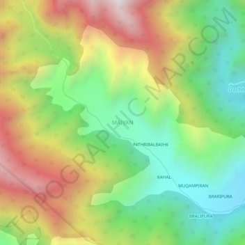
Name: MAIYAN topographic map, elevation, terrain.
Location: MAIYAN, Boniyar, Baramulla District, Jammu and Kashmir, India (34.15865 74.03265 34.19865 74.07265)
Average elevation: 2,339 m
Minimum elevation: 1,793 m
Maximum elevation: 3,086 m
Thank you for supporting this site ❤️
Make a donation
Make a donation
Gear up for your next adventure:
As an Amazon Associate, this site earns from qualifying purchases at no extra cost to you.