Geolocate

Lingqiu County topographic map

Click on the map to display elevation.

About this map

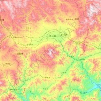
Name: Lingqiu County topographic map, elevation, terrain.

Location: Lingqiu County, Datong, Shanxi, China (39.04845 113.89149 39.65214 114.56551)

Average elevation: 1,250 m

Minimum elevation: 465 m

Maximum elevation: 2,198 m

Other topographic maps

Click on a map to view its topography, its elevation and its terrain.

Wufacun

China > Shanxi > Datong

Average elevation: 1,064 m

Aoshi

China > Shanxi > Datong

Average elevation: 974 m

Gear up for your next adventure:

🔦LED Flashlight - Powerful and long-lasting flashlight for camping and emergencies
🧴Insect Repellent - Protect yourself from bugs during outdoor adventures
🎒Fully Waterproof Backpack - Total protection for photography gear and electronics
🛰️Satellite Messenger - Emergency communication for areas with no cell service
Camping Tent - Weather-resistant tents suitable for 2 to 6 people

As an Amazon Associate, this site earns from qualifying purchases at no extra cost to you.