Geolocate

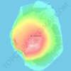
Désert de Morne topographic map

Click on the map to display elevation.

About this map

Name: Désert de Morne topographic map, elevation, terrain.

Location: Désert de Morne, Kerguelen Archipelago, French Southern and Antarctic Lands, France (-49.37684 70.39727 -49.35841 70.46133)

Average elevation: 3 m

Minimum elevation: -3 m

Maximum elevation: 22 m

Other topographic maps

Click on a map to view its topography, its elevation and its terrain.

Gear up for your next adventure:

🧰Survival Kit - Essential gear for emergencies in the wilderness
🛰️Satellite Messenger - Emergency communication for areas with no cell service
🥾Light Hiking Boots - Lightweight and comfortable boots for day hikes
🍽️Titanium Camping Spork - Ultralight and indestructible eating utensil
🛶Kayak Accessories - Essential gear for safe and fun kayaking adventures

As an Amazon Associate, this site earns from qualifying purchases at no extra cost to you.