
Birjand topographic map
Interactive map
Click on the map to display elevation.
About this map
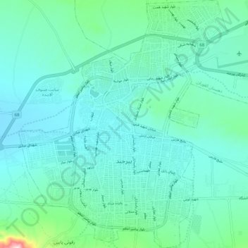
Name: Birjand topographic map, elevation, terrain.
Average elevation: 1,499 m
Minimum elevation: 1,431 m
Maximum elevation: 1,884 m
Other topographic maps
Click on a map to view its topography, its elevation and its terrain.
Birjand
Iran > South Khorasan Province > Birjand County > Birjand
Birjand, شهر بیرجند, بخش مرکزی, Birjand County, South Khorasan Province, 9718695461, Iran
Average elevation: 1,774 m