
Thank you for supporting this site ❤️
Make a donation
Make a donation
Gear up for your next adventure:
As an Amazon Associate, this site earns from qualifying purchases at no extra cost to you.
Puruhuay topographic map
Click on the map to display elevation.
Thank you for supporting this site ❤️
Make a donation
Make a donation
Gear up for your next adventure:
As an Amazon Associate, this site earns from qualifying purchases at no extra cost to you.
About this map
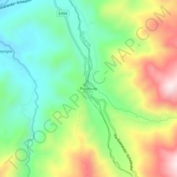
Name: Puruhuay topographic map, elevation, terrain.
Location: Puruhuay, Puruguay, Guaranda, Bolívar, Ecuador (-1.46533 -79.23363 -1.42533 -79.19363)
Average elevation: 638 m
Minimum elevation: 411 m
Maximum elevation: 1,000 m
Thank you for supporting this site ❤️
Make a donation
Make a donation
Gear up for your next adventure:
As an Amazon Associate, this site earns from qualifying purchases at no extra cost to you.