Geolocate

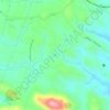
Vayakkal topographic map

Click on the map to display elevation.

About this map

Name: Vayakkal topographic map, elevation, terrain.

Location: Vayakkal, Kottarakkara, Kollam, Kerala, 691548, India (8.90432 76.83427 8.94432 76.87427)

Average elevation: 75 m

Minimum elevation: 42 m

Maximum elevation: 146 m

Other topographic maps

Click on a map to view its topography, its elevation and its terrain.
Kizhakkumbhagom kulam

India > Kerala > Kottarakkara > Chithara

Average elevation: 163 m

Gear up for your next adventure:

💡LED Headlamp - Hands-free illumination for night hiking and camping
🥾Approach Shoes - Shoes designed for climbing approaches and rugged trails
☕Camping Coffee Maker - Brew fresh coffee anywhere on the topographic map
🧢Beanie Hat - Keep your head warm in cold weather
🥾Hiking Gaiters - Protect legs and shoes from mud, snow, and debris

As an Amazon Associate, this site earns from qualifying purchases at no extra cost to you.