Geolocate

Alençon topographic map

Click on the map to display elevation.

About this map
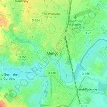
Name: Alençon topographic map, elevation, terrain.

Location: Alençon, Orne, Normandy, Metropolitan France, 61000, France (48.41031 0.06183 48.45183 0.12276)

Average elevation: 142 m

Minimum elevation: 127 m

Maximum elevation: 170 m

Other topographic maps

Click on a map to view its topography, its elevation and its terrain.
Moissy

France > Normandy > Orne > Gouffern en Auge > Chambois

Average elevation: 111 m

Menil Haton

France > Normandy > Orne > Valframbert

Average elevation: 145 m

Gear up for your next adventure:

🥾Light Hiking Boots - Lightweight and comfortable boots for day hikes
🛌Down Sleeping Bag - Superior warmth-to-weight ratio for cold nights
🦶Anti-Blister Balm - Prevents friction and hotspots during long ascents
🚲MTB Frame Bag - Carry tools and maps directly on your bicycle frame
🧢Sun Hat - Wide-brim hat for sun protection

As an Amazon Associate, this site earns from qualifying purchases at no extra cost to you.