
Brochet topographic map
Interactive map
Click on the map to display elevation.
About this map
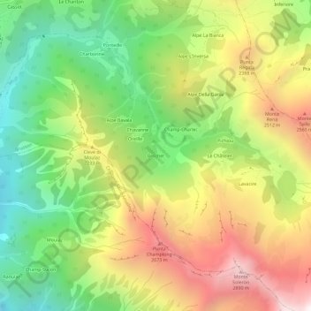
Name: Brochet topographic map, elevation, terrain.
Location: Brochet, Brusson, Aosta Valley, Italy (45.71647 7.76781 45.75647 7.80781)
Average elevation: 2,015 m
Minimum elevation: 1,235 m
Maximum elevation: 2,973 m