Geolocate

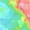
Anad topographic map

Click on the map to display elevation.

About this map

Name: Anad topographic map, elevation, terrain.

Location: Anad, Nedumangad, Thiruvananthapuram, Kerala, 695544, India (8.61307 76.99101 8.65307 77.03101)

Average elevation: 82 m

Minimum elevation: 47 m

Maximum elevation: 155 m

Other topographic maps

Click on a map to view its topography, its elevation and its terrain.
Aryanad

India > Kerala > Nedumangad > Aryanad

Average elevation: 105 m

Wildlife Sanctuary, Peppara

India > Kerala > Nedumangad

Average elevation: 539 m

Manickal

India > Kerala > Nedumangad > Vettinad

Average elevation: 67 m

Gear up for your next adventure:

🧢Sun Protection Cap - Breathable cap to protect from sun exposure
💡LED Headlamp - Hands-free illumination for night hiking and camping
🦌Outdoor Trail Camera - Monitor wildlife activity near your favorite spots
🧦Outdoor Socks - Durable socks designed for hiking and outdoor sports
🚑Survival Whistle - Signal for help across long distances in mountains

As an Amazon Associate, this site earns from qualifying purchases at no extra cost to you.