Geolocate

Centerville topographic map

Click on the map to display elevation.

About this map

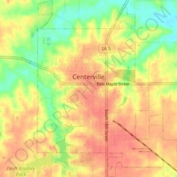
Name: Centerville topographic map, elevation, terrain.

Location: Centerville, Appanoose County, Iowa, 52544, United States (40.70811 -92.89205 40.75446 -92.84358)

Average elevation: 293 m

Minimum elevation: 261 m

Maximum elevation: 315 m

Gear up for your next adventure:

Camping Coffee Maker - Brew fresh coffee anywhere on the topographic map
🛶Waterproof Dry Bags - Keep electronics and clothes dry during river crossings
🔨Vehicle Emergency Tool - Safety tool for remote road trips to trailheads
🧢Hiking Sun Hat - Wide-brimmed protection for exposed mountain ridges
🧥Thermal Layer - Insulating layer for cold outdoor conditions

As an Amazon Associate, this site earns from qualifying purchases at no extra cost to you.