Geolocate

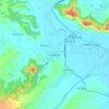
BANGUS VALLEY topographic map

Click on the map to display elevation.

About this map

Name: BANGUS VALLEY topographic map, elevation, terrain.

Location: BANGUS VALLEY, Handwara tehsil, Kupwara District, Jammu and Kashmir, India (34.34044 74.03013 34.38434 74.08601)

Average elevation: 2,934 m

Minimum elevation: 2,202 m

Maximum elevation: 3,318 m

Other topographic maps

Click on a map to view its topography, its elevation and its terrain.
Langate

India > Jammu and Kashmir > Handwara tehsil

Average elevation: 1,629 m

Handwara

India > Jammu and Kashmir > Handwara tehsil

Handwara is located at 34°24′N 74°17′E / 34.40°N 74.28°E / 34.40; 74.28 at an average elevation of 1,582 metres (5,190 feet) above sea level.

Average elevation: 1,638 m
Darnar

India > Jammu and Kashmir > Handwara tehsil

Average elevation: 1,981 m

Dional

India > Jammu and Kashmir > Handwara tehsil > Gung Bug

Average elevation: 1,881 m

Menganwar

India > Jammu and Kashmir > Handwara tehsil

Average elevation: 2,276 m

MAGAM

India > Jammu and Kashmir > Handwara tehsil

Average elevation: 1,713 m

Handwara

India > Jammu and Kashmir > Handwara tehsil

Handwara is located at 34°24′N 74°17′E / 34.40°N 74.28°E / 34.40; 74.28 at an average elevation of 1,582 metres (5,190 feet) above sea level. The region boasts breathtaking natural beauty, with the Pohru River (locally called 'Talri river')—a tributary of the Jhelum—flowing through the town.

Average elevation: 1,638 m

Gear up for your next adventure:

🛶Canoe Life Vest - Safety vest for water sports
⛺Family Camping Tent - Spacious tent suitable for family camping trips
🧴First Aid Kit - Essential first aid supplies for outdoor emergencies
🔋Emergency Crank Radio - Weather alerts and power without needing batteries
🚲MTB Frame Bag - Carry tools and maps directly on your bicycle frame

As an Amazon Associate, this site earns from qualifying purchases at no extra cost to you.