Geolocate

Hillsburgh topographic map

Click on the map to display elevation.

About this map
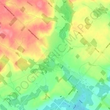
Name: Hillsburgh topographic map, elevation, terrain.

Location: Hillsburgh, Erin, Wellington County, Southwestern Ontario, Ontario, N0B 1Z0, Canada (43.77041 -80.16399 43.81041 -80.12399)

Average elevation: 449 m

Minimum elevation: 404 m

Maximum elevation: 494 m

Wellington County trails, hiking, mountain biking, running and outdoor activities

Gear up for your next adventure:

👟Leg Gaiters - Keep debris, mud, and snow out of your boots
🩹Moleskin Blister Pads - Direct protection for painful foot pressure points
🧢Sun Hat - Wide-brim hat for sun protection
⛺Lightweight Camping Tent - Portable shelter optimized for Canadian backcountry camping
🔪Outdoor Multitool - Versatile tool for repairs and food prep in the wild

As an Amazon Associate, this site earns from qualifying purchases at no extra cost to you.